Nvidia Jetson/Orin + FPGA + AI High-Compute Edge Computing Box: Highway Roadside System
Sichuan Expressway Construction and Development Group Co., Ltd. was established in July 1992 with a registered capital of 9.4 billion RMB, and is one of the direct subsidiaries of Shudao Group. Since its establishment, Chuan Gao Company has consistently upheld its responsibility as a state-owned enterprise, actively serving the overall development of the province, and fully promoting the investment, construction, and operation management of expressways and related supporting facilities, striving to improve the province's expressway network and service system. After 30 years of continuous exploration and development, Chuan Gao Company currently has over 60 wholly-owned, controlling, and participating subsidiaries, a total workforce of 14,000 employees, and operates a total of 5,693 kilometers of expressways. Standing at a new era and embarking on a new journey, under the strong leadership of Shudao Group, Chuan Gao Company will adhere to the guidance of Socialism with Chinese Characteristics for a New Era, be led by the "Two Roads Spirit," actively seize major strategic opportunities such as the construction of the Chengdu-Chongqing Economic Circle and the development of a strong transportation province, steadfastly fulfill its mission as a state-owned enterprise, continuously meet the people's aspirations for "smooth, safe, comfortable, and beautiful" travel, and contribute greater strength to the further advancement of Sichuan's governance and revitalization!
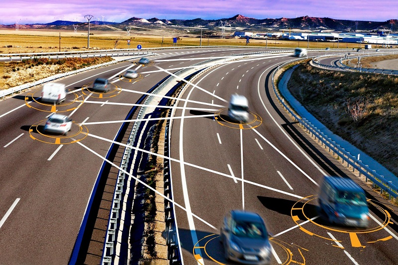
Current highway construction primarily focuses on ensuring traffic safety, enhancing transportation capacity, and improving service levels. With Vehicle-Road Collaboration as the construction direction, it involves building high-precision positioning, intelligent video surveillance, interactive traffic signs, highway cloud control platforms, and public travel service platforms for expressways. Based on the initially established roadside sensing equipment, management, dispatch, and service platforms are built to provide road users with Vehicle-Road Collaboration functions such as lane-level navigation, non-stop toll collection, forward collision warning, debris warning, special vehicle avoidance, ramp entrance warning, weather environment push notifications, and digital release of sign and billboard information.
For various application scenarios on expressways, by deploying roadside infrastructure and building front-end sensing and edge computing systems, combined with the functions and requirements of different scenarios, roadside Vehicle-Road Collaboration scenarios, ramp merging/diverging safety warning and guidance scenarios, and near all-weather assisted driving scenarios are established, to provide travelers with accompanying travel services, improve travel efficiency, and ensure travel safety.
- Roadside Vehicle-Road Collaboration System
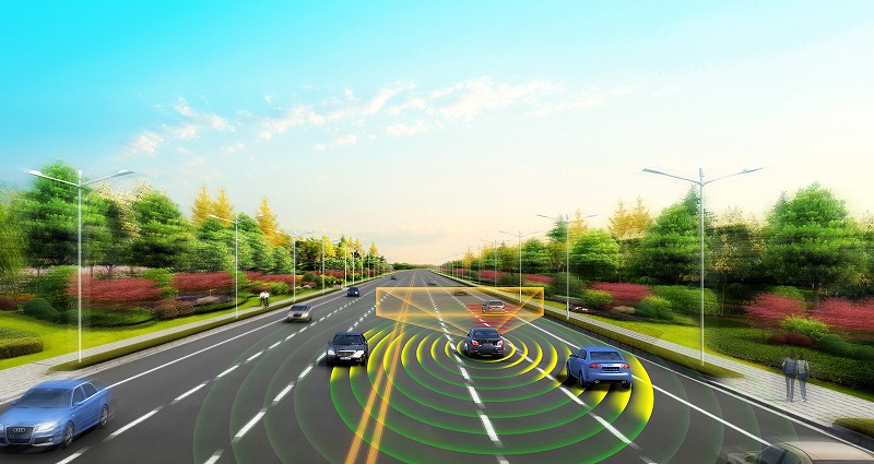
The roadside Vehicle-Road Collaboration system primarily consists of a roadside sensing subsystem, a roadside computing subsystem, and a roadside communication subsystem.
· Roadside Sensing Subsystem
It mainly collects roadside road conditions and performs event detection through devices such as high-definition cameras, millimeter-wave radars, LiDARs, and infrared dual-spectrum cameras.
· Roadside Computing Subsystem
It primarily manages devices such as radars and cameras through edge computing nodes, and performs fusion analysis of information collected by radars and cameras.
· Roadside Communication Subsystem
Communication with intelligent On-Board Units (OBUs) is achieved by Roadside Units (RSUs) via LTE-V 5.9GHz. The RSU broadcasts scenario-specific functional information to connected vehicles in a timely manner. After receiving it, the OBU calculates and determines whether to trigger corresponding information prompts based on the sensing information provided by the roadside, thus forming Vehicle-Road Collaboration application scenarios.
- Merging/Diverging Safety Warning and Guidance
Highway merging/diverging areas are regions where traffic flow changes, primarily including three typical scenarios: ramp interchange merging/diverging, hub interchange merging/diverging, and service area merging/diverging.
In merging/diverging areas, due to significant speed differences between mainlines and ramps, frequent lane changes, short lane change windows, and limited driver visibility, illegal driving behaviors and collision accidents are prone to occur.
By deploying Vehicle-Road Collaboration equipment at ramp merging/diverging points, vehicle safety and efficiency in these areas can be greatly improved. Safety warnings for vehicles can be realized at merging/diverging points, such as forward collision warning, merging zone safety alerts, diverging zone safety alerts, and road hazard warnings. Efficiency warnings for vehicles can also be realized, such as forward congestion alerts, speed limit warnings, and event warnings.
- Near All-Weather Assisted Driving
Near all-weather assisted driving sections utilize technologies and control methods such as traffic information monitoring, Vehicle-Road Collaboration, and edge computing. Through full-road sensing and communication coverage, holographic perception and publishing functions for the section are completed, enabling full-line vehicle tracking, real-time positioning, and real-time path guidance and safety warning functions. Near all-weather driving generally consists of a meteorological monitoring subsystem, a fog zone guidance subsystem, a Vehicle-Road Collaboration subsystem, and an intelligent information publishing subsystem.
Through diverse and intelligent means, near all-weather assisted driving information is promptly disseminated to non-connected vehicles, enabling event and weather warnings for near all-weather road sections and providing accurate and reliable information services.
Specifically, variable message signs along expressways provide broadcast information services in various forms such as text, graphics, and images; travel service websites use graphical interfaces to provide broadcast information services in various forms such as text, graphics, and images; traffic service hotlines are capable of receiving phone inquiries from traffic participants and providing targeted, personalized information services via voice; radio broadcasts, through cooperation with broadcast and television administration departments, provide broadcast information services over a wider area via voice; mobile SMS, through cooperation with telecommunication operators and SMS operators, provides broadcast information services over a wider area via text; mobile applications/mini-programs, WeChat official accounts, or third-party travel information service systems utilize 4G/5G networks to provide broadcast and personalized information services.